

I grabbed a few aerial photos off of WindowsLive -- for the slide show, scroll way down, down near the bottom of the page. Here's one still shot:

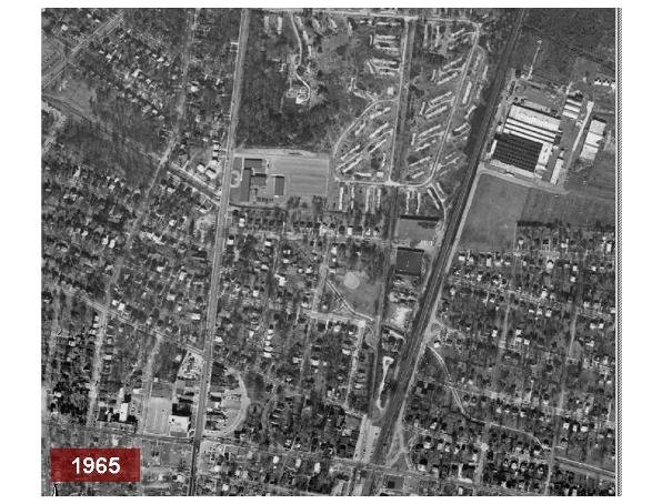
The above aerial shot, facing south, shows the Trolley Line trail (proposed hiker-biker trail route) cutting across the Cafritz property towards Riverdale Park Town Center, with the USPS facility to the west and the CSX tracks to the east.
You may click on the photo to see an enlarged version.
For more of these aerial photos of the Cafritz - WMATA area plus adjoining areas of Riverdale Park go to:
http://picasaweb.google.com/dwightrholmes
and choose the Cafritz album.

No comments:
Post a Comment